Ancient Mojave Watershed Lakes
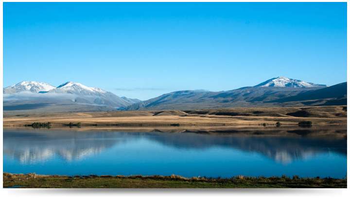
~ The Mojave River and Associated Lakes ~
The Mojave River is the largest drainage system in the Mojave Desert. It's modern extent and capacity is only a fraction compared to its extent during the Last Glacial Maximum. At its peak during this last ice age, the Mojave River drainage basin extended from the San Bernardino Mountains in the west; it flowed east and north ultimately merging with the Amargosa River before draining into Lake Manley in Death Valley. At this peak period, waters of the Mojave River drainage system flowed through, or contributed water to, several great Pleistocene Lakes: Lake Manix (which incorporated modern dry lake basins Afton, Troy, Coyote, Harper, and Cronese basins), and Lake Mojave (including dry Soda Lake and dry Silver Lake basins)(see the map on the Changing Climates & Ancient Lakes page). Today Soda Lake is the current terminal point of the Mojave River (although it has flowed into Silver Lake in historic times).
This drainage system evolved along with the changing landscape beginning in late Tertiary time when concurrent tectonic uplift of mountain ranges around the Mojave region and changes in regional climatic conditions were occurring. The modern river system began developing as westward-flowing stream drainages were blocked by the uplift of the Transverse Ranges along the greater San Andreas Fault System. The combination of blocked drainage systems and increased precipitation with the onset of cooler or ice age conditions at the close of the Tertiary resulted in the filling of basins with water (and sediments). Progressively through the latest Tertiary and into the Quaternary periods, lakes filled and stream overflowed through low divides between ranges and flooded adjacent basins. In this manner, the Mojave River evolved from the spilling over of lakes in the western Mojave Desert region. These large lakes do not exist today. Two large lakes that played perhaps a most significant role in the development of the landscape in the Mojave National Preserve area were Lake Manix and Lake Mojave. Sediments associated with these ancient lake deposits (and others in the region) record a story of climate change in the region.
Lake Manix was a large inland lake that was located in the Barstow, CA region (dry Troy Lake and Coyote Lake are remnants of this larger lake basin), and Mojave Lake in the Baker, CA region (dry Silver Lake and Soda Lake are remnants of this ancient lake basin). The development of these lakes and other lakes in the region was progressive with time, with Manix Lake filling first, and Mojave Lake forming later when the Lake Manix filled to capacity and spilled westward, ultimately carving Afton Canyon during the last glacial maximum about 18,000 years ago (Jefferson, 2003).
Debate remains whether earlier in the Quaternary the greater Mojave River drainage system (including Lake Manley and the Owens River drainage) filled to overflowing capacity and spilled into the Bristol Lake basin (south of the Mojave National Preserve), or possibly to the Colorado River (Enzel et al., 2003, Cox et al., 2003; Anderson & Wells, 2003). No water from the Mojave River system flows into the Bristol Lake basin at present or in the recent past. And in general, groundwater drainage systems follow patterns in surficial flow, but whether groundwater originating from the Mojave River basin ever makes it to the Colorado River is not resolved.
The synchronicity of lake formation with cooler and wetter climatic conditions in the Mojave region's past has been the target of abundant research from many angles and for many decades. Developing an understanding of climatic cycles (wet to dry) is fundamental to resolving changing landscape conditions (including plant cover, soil development, erosion, alluvial fan processes, playas and lakes, etc.); and understanding the relationships between these different variable elements. For instance, Soda Lake is now essentially a dry lake basin (a playa), of which only temporary flooding occurs on roughly a decade basis. Currently, the Soda Lake basin is fed by groundwater flow and episodic stream discharge from the surrounding mountain ranges and high-flow discharge from the Mojave River. Enzel et al. (2003) suggests that the average annual flow of the lower reaches of the Mojave River would have to be nearly a magnitude larger than the river's average current annual flow of 9,500,000 cubic meters. This 10-times volume would be necessary, along with reduced evaporative conditions, to maintain a lake consistent with the last glacial maximum. This means that rainfall amounts would probably need to be several times greater than current regional averages, and seasonal cooling and humidity would need to be significantly greater and last longer to overcompensate for evaporation effects. Currently, evaporative potential in the basin regions exceeds stream and groundwater flow input, and hence, today no lakes exist and desert conditions prevail.
The linkage of climatic changes with surface processes is only partly understood. There is undetermined lag between when cool and wet conditions start and when lakes can form and fill to their capacity. Also, the timing between the start of cool and wet conditions and the when ecological communities adapt and spread across the region may not not be synchronous. The reverse is true for changes from wet to dry conditions. Regional lake deposits show drying occurred about 9,000 years ago as sedimentary records transition from lake deposits, to intermediate marshland conditions, and to dry and desiccated playa conditions. The change from wet to dry conditions had a major impact on the ecology of the Mojave region (the vegetative cover and the animal species the landscape supported, including humans). Plant communities that were probably prevalent throughout the lower landscape regions are now restricted to the highest and wettest mountain areas, and probably many other species existed in the region that were adapted to a completely different seasonal pattern, but do not exist today. Likewise, aquatic or semi-aquatic species (fish, amphibians, turtles, arthropods, etc.) adapted to lake environments are restricted to spring-fed ponds or ephemeral spring fed streams, such as in portions of the Mojave River in Afton Canyon. The distribution of these species across the Mojave region (including in the Colorado River) may require a greater regional drainage system in prehistoric times.
...US Geologic Survey
~ Harper Lake ~
Harper Lake is presently a dry lake located in the Mojave Desert near the small community of Lockhart in northwestern San Bernardino County of Southern California. The lake is accessible from Harper Lake Road, which runs north off of State Route 58 midway between Boron and Barstow. The highest shorelines are dated to 24,400 ± 2,190 and 25,000 ± 310 radiocarbon years ago; further dates are 40,460 ± 550 and 33,830 ± 340 calibrated radiocarbon years ago. Lake Harper was the terminal lake for the Mojave River between 40,000 and 45,000 years before present, which is also considered to be the time of highstand of the lake;[4] the river alternatively discharged into this lake and into Lake Manix farther downstream.
The timespan where the Mojave River flowed into Harper Lake began 575,000 - 475,000 years ago when the river escaped the Victorville area and entered Harper Lake until 500,000 years ago when it started alternating between Lake Manix and Lake Harper. The last time that the Mojave River reached Lake Harper was between 25,000 and 20,000 years before present, but this finding was later considered to be doubtful.
Presently Lake Harper forms a playa at an elevation of 615 metres (2,018 ft) above sea level. It features a dry climate with desert scrub vegetation surrounding the lake bed. Neogene alluvial fans form much of the surrounding and overlie older basalts.
...Wikipedia
Presently Lake Harper forms a playa at an elevation of 615 metres (2,018 ft) above sea level. It features a dry climate with desert scrub vegetation surrounding the lake bed. Neogene alluvial fans form much of the surrounding and overlie older basalts.
...Wikipedia
~ Lake Manix ~
Lake Manix is a former lake fed by the Mojave River in the Mojave Desert. It lies within San Bernardino County, California. Located close to Barstow, this lake had the shape of a cloverleaf and covered four basins named Coyote, Cady/Manix, Troy and Afton. It covered a surface area of 236 square kilometres (91 sq mi) and reached an altitude of 543 metres (1,781 ft) at highstands, although poorly recognizable shorelines have been found at altitudes of 547–558 metres (1,795–1,831 ft). The lake was fed by increased runoff during the Pleistocene and overflowed into the Lake Mojave basin and from there to Lake Manly in Death Valley, or less likely into the Bristol Lake basin and from there to the Colorado River.
The lake formed about 500,000 years before present, when the Mojave River left the Victorville area and started to drain into Manix and Lake Harper. The lake did not immediately include the Afton basin; its integration occurred only about 190,000 years ago, most likely due to a catastrophic flood. Lake Manix lasted until 25,000–13,800 years ago, when Afton Canyon formed, either through slow downcutting or a large outburst flood.
The lake supported a rich ecosystem, including birds, fish, mammals and plants. A group of archeological finds in the area have been called, controversially, the "Lake Manix Industry".
The name "Lake Manix" was bestowed upon the lake by J. P. Buwalda in 1913; Buwalda also named its fossil-bearing sediments "Manix Beds". The name was derived from the Manix railroad siding of the Union Pacific, east of Barstow.
Lake Manix was located 32–64 kilometres (20–40 mi) east of present-day Barstow and Daggett, close to the town of Manix, California.
Lake Manix had a cloverleaf shape, formed by a northwestern Coyote Basin, a south-southeastern Troy Basin and an eastern-northeastern Afton Basin. The latter basin is heavily dissected in comparison to the first two. In the older history of the lake another basin named Cady Basin existed, before the Mojave River eroded through the Buwalda Ridge and connected it to the Afton Basin. This through-going erosion may have been assisted by the Manix Fault trace. A bedrock sill at 540 metres (1,770 ft) separates the Coyote Basin from the rest of the lake basin. The total surface area of the lake is given by sources as 236 square kilometres (91 sq mi). Earlier highstands may have reached Yermo, California. Yermo, together with Dunn and Newberry Springs, are present-day towns whose locations would have been close to the shore of, or submerged beneath, Lake Manix.
The upper threshold of the lake reached 543 metres (1,781 ft) above sea level; a shoreline at 549 metres (1,801 ft) was later shown to be an error of measurement,[15] although some poorly recognizable higher shorelines at 547–558 metres (1,795–1,831 ft) have been found. The stability of the 543-metre (1,781 ft) shoreline suggests that the lake either became much larger at that point or started to overflow.[18] These shorelines are marked by beach bars and wavecut scarps. Other landforms include alluvial fans, deltas, mudflats and their deposits. Part of the shoreline was buried by deposits transported by the Mojave River; these include large parts of a 557-metre-high (1,827 ft) shoreline. One island potentially existed in the middle of the lake; at a lake surface elevation of 558 metres (1,831 ft), the island would have become two islands separated by a narrow strait.[12] The lake reached a depth of 60 metres (200 ft).
The lake was surrounded by mountain chains: in clockwise order, the Cronese Mountains, the Cave Mountains, the Cady Mountains, the Newberry Mountains, the Calico Mountains and the Alvord Mountains. These mountains are principally of volcanic origin and contributed sediments to Lake Manix.
The whole region was subject to strong tectonically driven deformation from the Eastern California Shear Zone. A number of faults in the region show evidence of Holocene activity, including the Calico Fault, the Camp Rock Fault, the Dolores Lake Fault, the Pisgah Fault and the Manix Fault. This last fault probably contributed to the formation of the drainage by shearing rocks along its path. Distorted sediments, soil liquefaction remnants and sand blows have been identified in drilling cores from Lake Manix sediments; distorted sediments may be evidence that seismic activity occurred in the lake during its history. Earthquakes may have occurred on the several faults close to the lake and across the lake floor. The 1947 Manix earthquake occurred along the Manix fault.
The Mojave River entered the lake from the west, probably forming a river delta. The most recent drainage from the lake was Afton Canyon, which drained the lake east towards Soda Lake, Silver Lake and eventually Death Valley. This draining cut 120 metres (390 ft) deep into the sediments of Lake Manix, removing about 2.815 cubic kilometres (0.675 cu mi) of material and depositing it below Afton Canyon.
The playas Coyote Lake and Troy Lake presently fill the eponymous basins of Lake Manix. In many places, wind- and water-driven erosion has removed deposits from Lake Manix and obscured shorelines. The present-day Interstate 40 and Interstate 15 cross the former lake bed of Lake Manix.
During the ice ages, a number of lakes filled in the Great Basin and the southwestern United States. These lake fillings were influenced by shifts in storm tracks caused by the Laurentide ice sheet. Changes in sea surface temperatures increasing moisture supply or increased supply from tropical regions may also have contributed to lake formation. Similar lakes included Lake Babicora, Lake Bonneville, Lake Estancia, Lake Lahontan, Lake Manly, Lake Owens, Lake Panamint, Lake Russell and Lake Searles.[32] Some interglacials also featured the growth of lakes. Under present-day climate, runoff in the region is also influenced by the El Niño Southern Oscillation, the Northern Annular Mode and the Pacific Decadal Oscillation;[33] the Northern Annular Mode may have affected the infilling of Lake Manix as well.
The Mojave River drained into Lake Manix, with the formation of the lake reflecting increased precipitation in the San Bernardino Mountains. Local arroyos also drained into the lake. It has been estimated that runoff had to increase by a factor of about ten to form Lake Manix. Lake Manix contained over 1.6 cubic kilometres (0.38 cu mi) of water, possibly as much as 3.2 cubic kilometres (0.77 cu mi). Water levels in the lake frequently fluctuated by 5–15 metres (16–49 ft). It formerly was the Mojave River's terminal lake, and received about 1 millimetre per year (0.039 in/year) of sediment. The Coyote Basin was not permanently coupled to the main lake body; its relatively large surface area and consequently high evaporation would have stabilized lake levels when it was connected to Lake Manix proper.
Tufa, a type of calcium carbonate deposit that develops in waterbodies, formed within Lake Manix. Based on information gleaned from fossil ostracods, Lake Manix was a well mixed lake, especially in summer; likely, no thermocline[a] developed in it. While the lake may have been warm during oxygen isotope stage 12 and possibly nourished from early summer runoff, after that point it was much colder, with water temperatures not rising above 4 °C (39 °F). After oxygen isotope stage 5, the lake became warmer again. The environment of Lake Manix has been compared to shallow lakes in northern California that lie behind the Cascade Range.
...Wikipedia
~ Lake Mojave ~
On the western side, Lake Mojave was bordered by mountains that steeply rise from the basin. The eastern side is more gentle, featuring alluvial fans and pediment.
At its maximum stand, Lake Mojave had a surface area of 300 square kilometres (120 sq mi) and a volume of 7 cubic kilometres (1.7 cu mi). Lake Mojave had two separate lake level stands, the A stand and the B stand. The A stand lies at an altitude of 287 metres (942 ft) above sea level and the B stand at an altitude of 285.4 metres (936 ft). The lake was about 10 metres (33 ft) deep.
15 alluvial fans abut the shores of Lake Mojave that face the Soda Mountains. A present-day 40 kilometres (25 mi) bay exists on the northwestern side of the Silver Lake basin and includes wavecut terraces and a beach ridge.
Silver Lake and Soda Lake exist today where Lake Mojave formerly existed. Soda Lake slopes to the north and lies at a higher altitude than Silver Lake, thus water tends to fill Silver Lake first. Beach ridges and shorelines testify to the existence of a past lake in the Silver Lake basin. One major beach ridge complex is named the El Capitan Beach Ridge complex and contains gravel and sand.
Sediments from Lake Mojave and its two successor basins may be part of the sources of sand for the Kelso Dunes. Dating of dune deposition suggests that the deposition events often correspond to times where water levels in Lake Mojave were less stable.
The Mojave River is the principal river reaching the Lake Mojave basin. Most water of the Mojave River ultimately comes from the San Bernardino Mountains, 201 kilometres (125 mi) southwest. Precipitation increased in response to southward shifts of the polar jet stream; this and floods probably contributed to the formation of Lake Mojave.
The Mojave River flows into the Mojave Desert since about 2-1.5 million years ago, when its previous southward course was blocked by the uplift of the Transverse Ranges. The Mojave River did not always end in Lake Mojave; at other points of its history it reached Lake Harper, Lake Manix, the Cronese Lakes and Lake Manly. Lake Mojave was reached about 20,000 years before present by water overflowing from Lake Manix. Compared to today, water flow would have to be at least ten times higher to allow for the formation of Lake Mojave.
A bedrocklined channel extends from a bay on the northern side of Silver Lake and forms the outlet of Lake Mojave. It is at times less than 3.0 metres (10 ft) wide. The channel terminates into Dry Lake playa, 4.8 kilometres (3 mi) away. This spillway stabilized the levels of Lake Mojave during the late Pleistocene.
It was once thought that overflow from Lake Mojave was nourishing a freshwater Lake Dumont, but later ostracod research indicated that that area was groundwater-supported wetland. Water from Lake Mojave eventually reached the Amargosa River and Death Valley.
Lake Mojave existed between 22,000 and 9,000 years before present.
Based on the Wells chronology, the lake filled before 27,000 years before present and from then on fluctuated below the A-shoreline. The lake was stable at the A-shoreline 21,900 - 19,750 and 16,850 - 13,850 years before present. The early phase is also known as Lake Mojave I, while later phases are also known as Lake Mojave II.
Alternative age ranges are 20,900 - 19,600 for Lake Mojave I and 16,500 - 13,400 for Lake Mojave II. Water draining from Lake Manix after the formation of Afton Canyon may have aided in the development of Lake Mojave,[28] although much of the water would have continued into Death Valley due to the insufficient volume of the Lake Mojave basin.
Between 13,600 and 11,500 years before present, the formation of a spillway caused Lake Mojave to abandon its A-shoreline and drop to the B-shoreline. Lake Mojave stabilized at the B-shoreline until 8,700 years before present. Other estimates assume a drying about 9,700 years before present.
The disappearance of Lake Mojave was caused by climatic changes at the start of the Holocene. Wind erosion affected the beach and delta deposits left by Lake Mojave, forming aeolian sediments.
Presently, only rarely do lakes form in the basin of Lake Mojave. Individual occurrences occurred in 1916-1917, 1938-1939 and 1969; this latter lake stage was photographed and it submerged the Tonopah and Tidewater railroad. Other infillings occurred 3,910 ± 152 and 470 ± 160 years ago. Such resurgences of the lake depend on anomalously high precipitation on the San Bernardino Mountains, and are climatically linked to the Little Ice Age and other glacial expansion episodes.[34] The existence of such lakes was not only limited by climate factors but also by a generally shallow lake basin that caused a strong increase in evaporation with only slight increases in water levels.
A steady food and freshwater supply as well as the presence of rocks that could be used to manufacture tools drew early humans towards Lake Mojave. As lake levels dropped, people migrated progressively farther down to reach the lake.
Some presumably archaeological sites have been found at Lake Mojave, including alignments of basalt boulders. Bifaces and projectiles have been found on its shores, the latter are dated about 10,000 - 8,000 years before present, these archaeological findings are known as the "Lake Mojave" complex.
The so-called "Lake Mojave complex" is a cultural system that was active between 9,000 and 6,000 BC. Possibly, such cultures were derived from the Clovis culture and formed when big mammals disappeared and early humans had to search for different sources of food.
...Wikipedia
~ Soda Lake ~
Soda Lake (or Soda Dry Lake) is a dry lake at the terminus of the Mojave River in the Mojave Desert of San Bernardino County, California. The lake has standing water during wet periods, and water can be found beneath the surface.
Soda Lake along with Silver Lake are what remains of the large, perennial, Holocene Lake Mojave. The waters of the lake, now with no outlet, evaporate and has left alkaline evaporites of sodium carbonate and sodium bicarbonate.
Soda Lake along with Silver Lake are what remains of the large, perennial, Holocene Lake Mojave. The waters of the lake, now with no outlet, evaporate and has left alkaline evaporites of sodium carbonate and sodium bicarbonate.
Soda Lake is located on the southern side of Interstate 15, and can be seen at the Zzyzx Road interchange and the Oat Ditch bridge, as well as the Soda Lake bridge (signed as the Mojave River) looking south from Baker.
...Wikipedia
...Wikipedia
~ Silver Lake ~
Silver Lake is a dry lake bed in the Mojave Desert of San Bernardino County, California, along Interstate 15, 100 km (62 mi) northeast of Barstow.
Silver Lake, along with the adjacent Soda Lake, is what remains of Lake Mojave, a large, perennial lake that existed through the Holocene.
Silver Lake, along with the adjacent Soda Lake, is what remains of Lake Mojave, a large, perennial lake that existed through the Holocene.
Silver Lake is a dry lake bed in the Mojave Desert of San Bernardino County, California, along Interstate 15, 100 km (62 mi) northeast of Barstow.
Silver Lake, along with the adjacent Soda Lake, is what remains of Lake Mojave, a large, perennial lake that existed through the Holocene.
...Wikipedia
Silver Lake, along with the adjacent Soda Lake, is what remains of Lake Mojave, a large, perennial lake that existed through the Holocene.
...Wikipedia
~ Coyote Lake ~
Coyote Dry Lake is a dry lake bed in the Mojave Desert of San Bernardino County, California, 15 mi (24 km) northeast of Barstow. The lake is approximately 10 km (6.2 mi) by 6 km (3.7 mi) at its widest point.
Coyote sits at the northern portion of ancient Lake Manix and is a remnant. The Lake lies to the south of Fort Irwin Military Reservation and southwest of the Tiefort Mountains.
...Wikipedia
...Wikipedia
~ Other lakes and streams in the watershed ~
~ Troy Lake is a remnant of Lake Manix but sits on the southern portion of Manix.
~ East and West Cronise Lakes were part of drainage system and north of Lake Mojave.
~ Lake Manly was a pluvial lake in Death Valley, California, covering much of Death Valley.
~ Amargosa River, drainage beyond Silver Lake northward to Lake Manly and Death Valley.
~ Kelso Wash, drainage of Mojave lake to the southeast, possibly to Bristol Lake.